


The VIS4ION-Thailand project develops a real-time navigation assistance system for visually impaired individuals using AI and assistive technology. This wearable device helps users access environmental information for safe and independent travel. Prototype testing was conducted at Mahidol University's Salaya Campus, utilizing advanced computer vision techniques to create digital maps and dynamic navigation information.
VIS4ION (Visually Impaired Smart Service System for Spatial Intelligence and Onboard Navigation)
share :
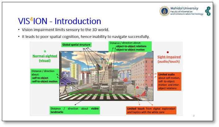
Currently, the number of people with visual impairments is increasing due to vision-related diseases and the health conditions of the elderly. According to the World Health Organization's report (2011), there are 39 million blind people and 246 million people with low vision worldwide. In Thailand, visual impairment ranks as the third most common type of disability. Impairments in visual processing and perception reduce access to three-dimensional information, posing significant obstacles to communication, physical movement, daily activities, and travel. These challenges affect physical activity levels, educational opportunities, employment prospects, and overall quality of life.
The VIS4ION-Thailand project is a navigation assistance system for visually impaired individuals, utilizing real-time data through AI technology combined with assistive technology (AT). AT is a term that encompasses hardware devices, software, or services that enhance accessibility for individuals. Mobility aids that focus on direction learning and navigation functions, and the integration of spatial information typically associated with vision, are key components. These devices employ advanced technology to provide route guidance, object recognition, and obstacle avoidance for visually impaired individuals.
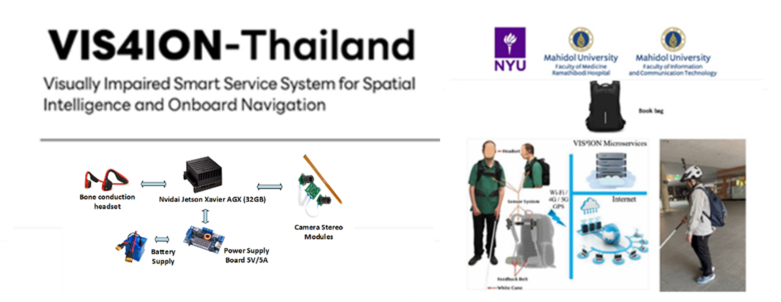
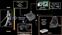
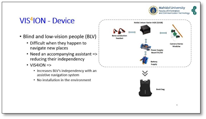
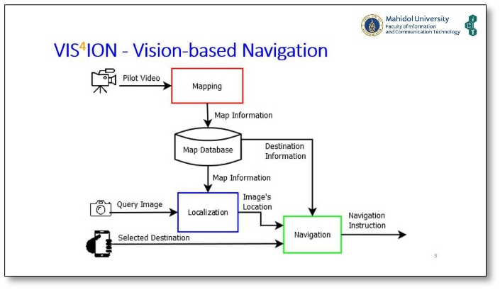
Development of VIS4ION The wearable VIS4ION (Visually Impaired Smart Service System for Spatial Intelligence and Onboard Navigation) device is an AI EDGE technology designed to assist with personal mobility and navigation. It is a customizable platform that involves human oversight in the process, delivering information to users and providing real-time navigation guidance. This research project was developed to help visually impaired individuals navigate independently in new environments. The device will enable users to easily access information about their surrounding environment, aiding in safe navigation and travel to their destinations.
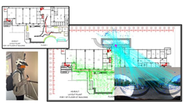
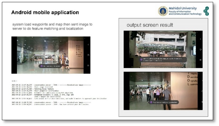
The prototype system for VIS4ION research and development involves creating a digital map of Mahidol University's Salaya Campus (covering seven faculties and outdoor routes connecting them) and using advanced computer vision techniques to digitize spatial environments (mapping) and provide dynamic navigation information (positioning). This supports spatial awareness for visually impaired individuals. The digital data is housed in a small portable computer with a battery, an environment imaging camera, and a headset for interactive communication about the digital spatial information stored in the database and the user's navigation commands. All components are integrated into a backpack for convenient portability.


Partners/Stakeholders
1. The U.S. National Institutes of Health (NIH) 2. New York University (NYU)
** The mentioned project is a collaboration between researchers from NYU and Mahidol University. [Funding: NIH]
ผู้ดำเนินการหลัก
Dr. Wachara Riewpaiboon
ส่วนงานหลัก
ผู้ดำเนินการร่วม
Dr. Pattanasak Mongkolwat
ส่วนงานร่วม
This website values privacy. To give you a good experience on our website If you use this website
Without any adjustments, you are agreeing to our use of cookies and our privacy notice.
More details